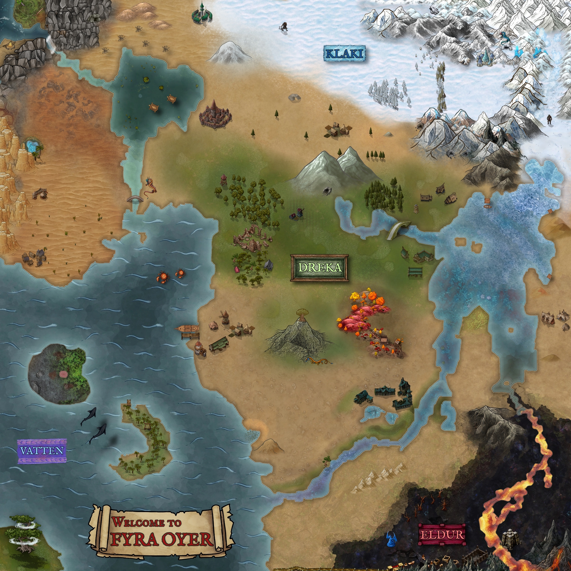
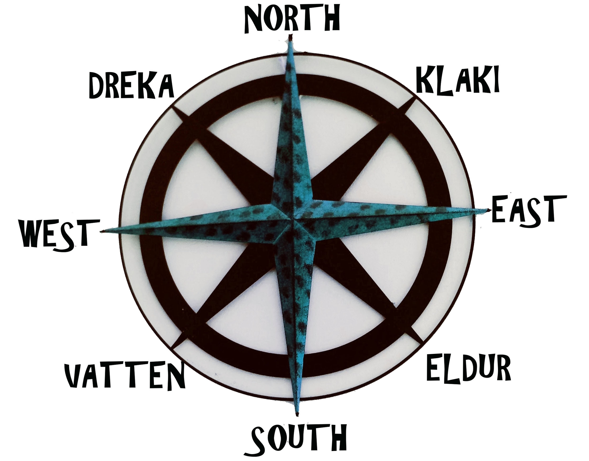
Land Distinctions
In the time of Sucatras and the generation of dragons that existed prior to the Purge of Drakon, there were four distinctions of land across Fyra Oyer. Vattenland was an island in the southwest corner, Eldurland in the southeast, Klakiland in the northeast, and Drekaland stretched through the northwest and along the western coast. Dragons used these landmasses for their general terms of direction (see Compass of Fyra Oyer), abbreviating them when in description- for example, to head “Eldur” would be to travel towards Eldurland.
After the re-appearance of Drakon and the subsequent disappearance of the adult dragons, the titles of these lands became abbreviated. Each dropped the term “land,” as (as stated by Unbryn-Brinnle) none of the previous land existed as it was before. Additionally, everything the new hatchlings had learned of the geography was from ruins and language left behind (along with the periodic information they could glean from Cave Dragons). Subsequently, they believed the areas to be called that of the compass directions themselves anyway.
Last updated